Dendra is rapidly expanding its footprint as mining companies and regulators come to understand the gravity of its environmental solutions.
Environmental permits and approvals are key milestones mining companies must achieve before they can bring a new mine online.
And while operators must demonstrate compliance pre-mining, they also have an obligation to maintain their environmental standards during and after production.
To better position themselves during both pre-mining and production phases, miners are turning to technology to gather faster and more comprehensive environmental insights – and Dendra has become a key partner on this journey.
Through its RestorationOS solutions, Dendra deploys drone and remote sensing technologies to map and survey large areas of land. Artificial intelligence (AI) is then used to analyse and convert the data into actionable insights.
While ‘boots-on-ground’ surveys have been the traditional data capture method, regulators are increasingly understanding the advantages that remote-sensing alternatives can offer.
As more regulators have their ‘aha moment’ regarding the upside of AI and environmental technology, Dendra is working closely with its customers to ensure their data capture puts them in the best position to expedite approvals and satisfy reporting requirements.
“We work with our clients to capture insights on their rehab to help them manage and meet their regulatory reporting needs,” Dendra Australia ecology manager Jason Webb told Australian Mining.
“Then, as we enhance traditional survey methods with Dendra insights, we can slowly move towards fewer ground surveys and more remote sensing. As spatial ecology keeps evolving, it is increasingly being used in the industry.”
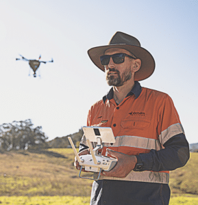
Image: Dendra
While Dendra’s technology is relatively new in the mining industry, the company’s footprint is rapidly expanding.
Dendra welcomed a record number of customers in 2023. This coincided with the company increasing its mapping capacity, which improved by a multiple of four across the 12 months, meaning more hectares can be surveyed more quickly.
Dendra has also evolved its aerial seeding technology to the point that it can spread up to 44 hectares a day of native seed mixes – a 10-fold increase in just a decade.
And there is further advancement to come, with research and development (R&D) focused on enhancing Dendra’s ecology-trained AI and management tools.
“Our ecology-trained AI is getting faster, more accurate and more scalable, meaning we’ll be able to take on more clients over larger areas and deliver our solutions faster,” Webb said.
“As our scalability increases, our output will increase, further increasing the ability for spatial ecology to enhance traditional ground surveys in the mining industry.”
Enhancing traditional ground surveys with spatial ecology means Dendra’s technology and insights will become increasingly used in the industry and applied in environmental approvals for pre-mining and rehab.
“Regulators are gaining greater visibility on how remote sensing can enhance mining regulatory submissions and traditional ground surveys, leading to more discussions on the best ways to incorporate remote sensing into biological surveys across Australia,” Webb said. “Bringing new technologies together with biological ground surveys gives new opportunities to progress rehab and mining towards better environmental outcomes and helping mine sites meet regulatory compliance.
“Species-level analysis and identification has been the main focus of Dendra’s work for the past few years. As we enhance ground surveys, we believe we can achieve an even stronger footprint and be integrated into many different types of flora surveys.”
In today’s mining industry, Webb said, ground surveys are supplemented by aerial surveys. But Dendra wants to “flip this around”.
“We want to get to a point where aerial surveys are enhanced by ground surveys, integrating the two approaches together,” he said. “This reduces time and people on ground, and it increases remote detection accuracy, because rather than doing a few subplots around the site as is done with traditional ground survey methods, we could survey and assess an entire mine.”
As it invests in more R&D and achieves further uptake and more regulatory exposure, Dendra is driving a new paradigm in ecosystem restoration and environmental management.
“It’s only a matter of time until regulators understand the gravity of Dendra’s faster, more scalable and more reliable environmental solutions.”
This feature appeared in the September 2024 issue of Australian Mining.


